
Ontario opens a new door for developers seeking to expand towns onto farmland
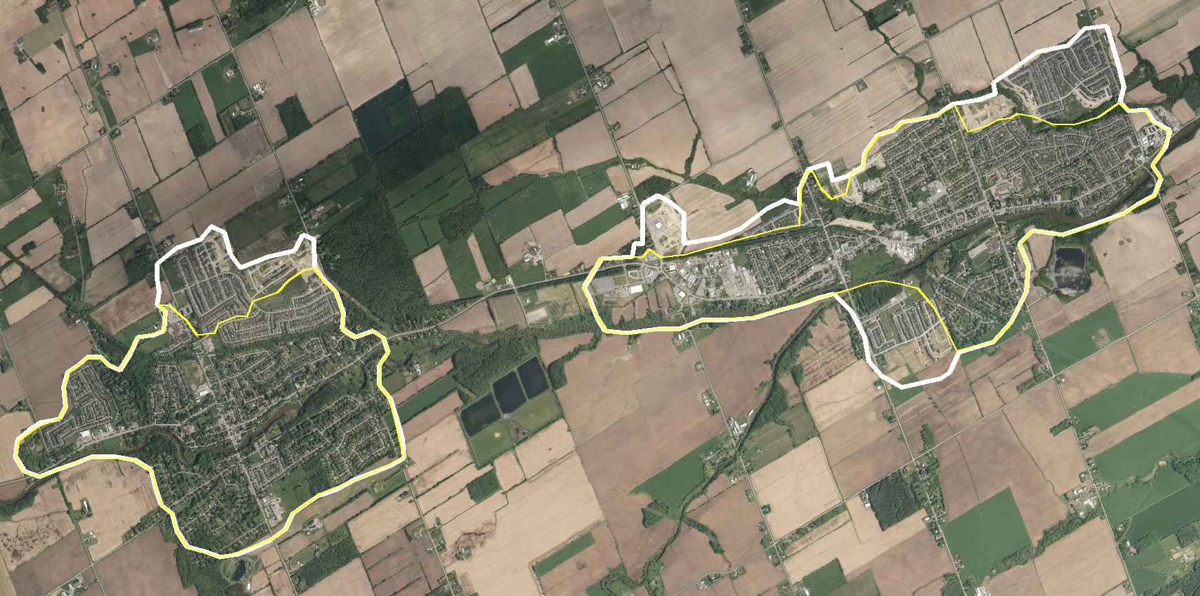
Source: Ontario DRAPE aerial imagery, 2008 and 2024. © King’s Printer for Ontario, 2022. Open Government Licence – Ontario.
Ontario has opened a new route for developers to challenge the boundaries municipalities set for their development putting more pressure on local governments who want to defend farmland and to have a larger say in where housing is built.
A settlement boundary marks the land set aside for a town or village’s development. Before 2024, moving it generally required a review of the whole community. How many people and jobs are expected? How much growth could fit on land already set aside? What roads, water, and sewers could be needed? The review could be part of an official plan update or an amendment adopted by the municipality responsible for the plan.
In 2024 Ontario ended that requirement but only outside the Greenbelt, a legally protected zone in the Golden Horseshoe around Toronto and neighbouring communities. Outside the Greenbelt landowners can now appeal a municipality’s refusal or delay on a request to expand a settlement boundary.
The Greenbelt has its own planning rules to protect farmland, water and natural areas from urban growth. Provincial estimates based on 2021 census figures put only about 6.7 per cent of Ontario’s total farm area inside it. Russell Township is outside the Greenbelt. Its farmland has regular planning protections but not the extra ones.
The tribunal is an independent body that settles planning disputes. It does more than decide whether a developer or town can read a plan correctly. A developer who wants to expand a town’s boundary is asking to change the official plan, the town’s long-term land-use strategy, so the housing can be built. If a developer appeals a refusal the tribunal can approve, change or reject that change even if the municipality objects.
A stronger hand for developers
Photo: University of Guelph faculty page.
Mollie Kuchma, an assistant professor of rural planning and development at the University of Guelph, sees a clear provincial direction behind the changes. She said the Conservatives have repeatedly changed planning laws since taking office in 2018.
“The province is going to make sure that developers can build. That seems to be their mandate right now.”
Kuchma worked as a land use planner for more than a decade, including eight and a half years in Milton. She has also worked for Bruce County and the Grand River Conservation Authority.
Municipalities still have tools to shape growth, she said, but they need policies that say what they want before development proposals arrive.
“You kind of want the policy to dictate the growth.”
Hamilton’s boundary put to the test
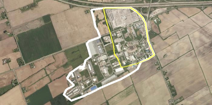
Source: Ontario DRAPE aerial imagery, 2008 and 2024. © King’s Printer for Ontario, 2022. Open Government Licence – Ontario.
A recent Hamilton case shows why that preparation matters and why even a clear municipal position may not win. Hamilton wanted to make room for growth without pushing its urban boundary farther into the countryside. Landowners argued the city needed more land for housing. The landowners appealed to the Ontario Land Tribunal because the city had not decided on their expansion applications.
The tribunal’s first job was to decide how much more land was needed. In an Aug. 17 ruling it ordered Hamilton to plan for at least 1,600 hectares of additional developable land. It disagreed with key assumptions behind the city’s plans including the mix of homes needed to meet demand. Decisions about specific expansion areas were left for a later stage.
The ruling showed that the city’s boundary was not the final word. It was not the end of Hamilton’s say in what gets built either because the city had prepared a fallback deal.
Hamilton had already negotiated an agreement with the landowners behind the Twenty Road West proposal in case the tribunal ruled that expansion was needed. When the city lost that argument it asked that the hearing on those lands become a hearing on the agreement. The tribunal approved the settlement in September.
The deal included commitments to provide affordable housing, keep land for jobs, and put the necessary infrastructure in place before building began. They were not penalties for losing the first hearing because the developer agreed to those terms. Further planning and development approvals were still needed.
An agreement can give a developer a clear path forward instead of a long fight.
“However, we do know that the OLT does tend to favour private sector developments over municipal decisions in many instances,” Kuchma said.
She warned that councils sometimes reject proposals that meet their own planning policies often because residents object. That can give developers grounds to win on appeal.
Planning disputes closer to home
In 2021, the tribunal overturned Champlain Township’s refusal to rezone land for the Colacem cement plant near L’Orignal. That was a zoning dispute under the earlier rules not an appeal using the new boundary expansion route.
In Limoges in 2018 the tribunal upheld the county’s approval of a 31-unit townhouse development despite opposition from residents and The Nation council. In that case residents were appealing an approval not a developer appealing a refusal.
What Russell’s plans can do
For Russell Township the question is how much its recent planning work helps it respond to this pressure. The township adopted a new official plan in May 2025 and the United Counties of Prescott and Russell approved it this April. It sets out policies for managing growth. Expanding a settlement boundary requires amendments to both the township’s plan and the county’s plan.
That means a developer who wants to expand a village must ask to change what both governments have planned for that land. The new appeal power does not remove that step. It lets a developer challenge the answer if the municipality says no.
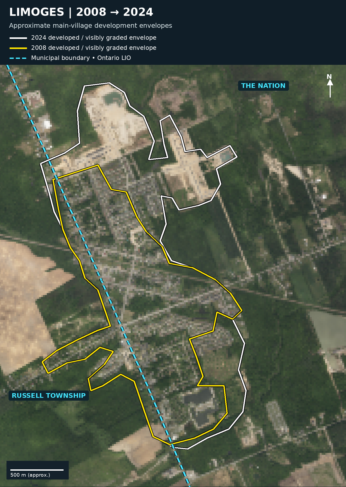
Source: Ontario DRAPE aerial imagery, 2008 and 2024. © King’s Printer for Ontario, 2022. Open Government Licence – Ontario. Municipal boundary: Ontario Land Information (LIO).
The township’s and county’s official plans give grounds for questioning a proposal:
- Is more land needed?
- Could more homes be built on land already in use in town, for example by replacing an older building with one holding more homes?
- Is there unused land already set aside for growth?
- Can water and sewer services support the proposal?
- Is there an alternative that would harm agriculture less?
Clear policies backed by current studies may help the township defend a refusal or shape a development if it goes ahead. Some safeguards were already in earlier plans. The county’s currently posted official plan took effect in July 2023 before the provincial changes. It includes farmland protections and tests for expansion but it still refers to the earlier provincial planning framework.
Kuchma has not reviewed the local plans but if a municipality doesn’t pay enough attention to the kind of growth it wants she warned, “you could end up with just sprawling subdivisions.”
For farmland, the effects last.
“We know that it’s not going to be returned to agricultural land in the future,” she said.
Her advice is to set clear planning policies before the next application arrives. That means deciding where new neighbourhoods should go, what mix of homes they should include, and what shops and services should come with them. She gave townhouses and triplexes as examples of housing that could be included so that not every proposal is made up only of detached houses.
“So creating a policy framework that dictates how you want to grow is your best option because it gives you something to work with.”
What comes next
Kuchma described a second stage of the Hamilton case that municipalities are now watching closely. It moves from how much more land the city needs to which properties should be brought inside its urban boundary. It looks at whether the land connects to existing neighbourhoods, whether services can support it, and whether it is a suitable place for the community to grow. The Twenty Road West proposal was settled by agreement but the bigger question is how the tribunal will weigh those issues when developers and municipalities disagree.
“A lot of municipalities are watching this very closely because once the OLT makes decisions and we start to see how the tribunal is making decisions that will influence how other municipalities will review these applications in the future.”
Sources
- Mollie Kuchma interview, November 2, 2026
- Ontario: Bill 185 planning changes
- Ontario Land Tribunal: powers and appeals
- Provincial Planning Statement, 2024
- Provincial Policy Statement, 2020
- Ontario Greenbelt Plan
- Hamilton land-needs ruling, August 17, 2026
- Hamilton: Twenty Road West settlement, September 15, 2026
- Hamilton: Twenty Road West decision, September 29, 2026
- Russell Township Official Plan
- United Counties of Prescott and Russell Official Plan
- Colacem tribunal decision, April 12, 2021
- Limoges tribunal decision, November 21, 2018
- Ontario Greenbelt farm-area estimates: 2021 workbook
- Statistics Canada: 2021 agricultural land-area tables
- Ontario DRAPE 2008 aerial imagery
- Ontario aerial imagery service: DRAPE2024 collection
- Ontario LIO municipal boundaries
- Open Government Licence – Ontario
- Mollie Kuchma: University of Guelph faculty profile