
The Old Forced Road
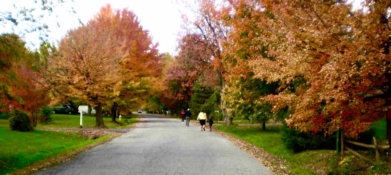
Russell’s Old Forced Road was a settlement road that brought early European settlers inland from communities along the St. Lawrence and Ottawa rivers. Its history is part of the story of how settlement spread into the surrounding countryside.
Local historian Harry Baker traces the road’s origins, beginning with the surveys that divided the land into townships, concessions and lots, and the road allowances intended to connect them.
The American Revolution and the arrival of the United Empire Loyalists led to the Constitutional Act of 1791, which separated the Province of Quebec into Upper Canada and Lower Canada.
Upper Canada was surveyed in the British system; the townships were 10 miles x 10 miles square. Each township was laid out in concessions (from west to east) and lots (from south to north).
A 66-foot (the length of a surveyor’s chain) road allowance running approximately north-south was located between the concessions and a similar road allowance running east-west was located between every five lots.
By 1822, the survey was completed in Russell Township to mark out the plots for the new settlers. The lots were laid out in 200 acres.
To help the Loyalists, the head of every household was granted 200 acres (80 hectares) of land, every son when he became of age and every daughter upon marriage received the same land grant.
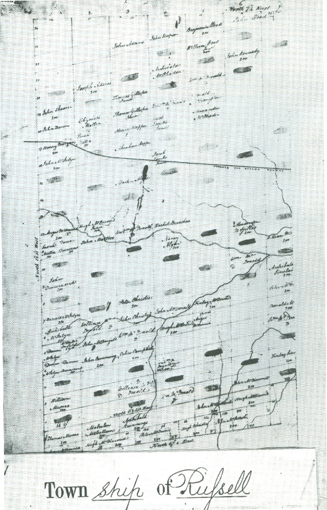
The earliest map of Russell Township showing the concessions, and lots was made in 1825 and showed the first owners (Stanley, 1987). This map had no roads indicated.
The Canada Company a large private chartered British land development company, was incorporated in 1826 to aid in the colonization of a large part of Upper Canada. Originally formed to acquire and develop the undeveloped clergy reserves and crown reserves which, in 1827, the Company acquired for £341,000 ($693,000) from the Province of Upper Canada.
By 1827, the Canada Company was the largest landowner in Russell Township (Stanley, 1987). Their land surveyor, Duncan McDonnell, reported that there was only one settler in the region, a Mr. Elisha Loucks had established a small farm and a sawmill on the “Castere River”. He described the land as consisting of large swamps with white sandy bottoms. He also indicated that there were no roads.
The first map that showed a road was the 1841 assessment map. This map also listed the names of the first landowners. As already noted, not all of the original lot owners ever settled here.
Wendell Stanley (Stanley, 1987) wrote on this map the location of a Forced Road as it passed through Russell Township.
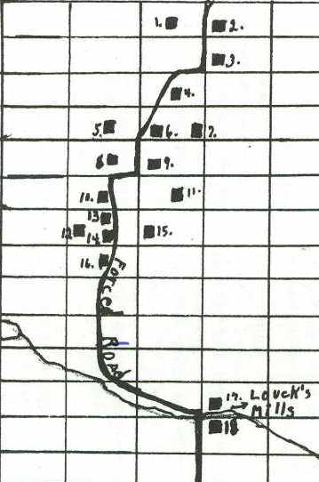
While the surveyors map shows neat straight lines laying out the Lots and Concessions, there was uneven ground and swamps that made it difficult to build roads. The roads were often diverted away from the road allowances to find easier ground or to run along side rivers. These were called “forced roads” and while they were legitimate township roads, they often cut across lot lines to find the easiest path to get around obstacles in a public road allowance, such as a rock outcrop, a steep hill or a swamp.
Although the deviations were trespasses, the owners of the trespassed land were usually grateful for the access and often acquiesced without seeking compensation. When there was acquiescence, local authorities typically did not bother to follow-up with the expensive busy-work of surveying and purchasing or expropriating the trespassed land after construction. Until the local road authority acquired the legal title to the land used for the roadway, it remained a "forced road."
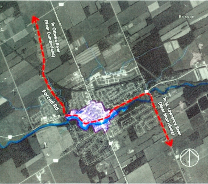
The old Forced Road through Russell Village was thought to follow an ancient trail used by First Nation people to access this area for hunting, fishing and the collection of natural products like butternuts, and medicinal plants. The trail extended from the St Lawrence River (near present day Morrisburg) in the south to the Ottawa River (near present day Cumberland) in the north.
Historical Plaques
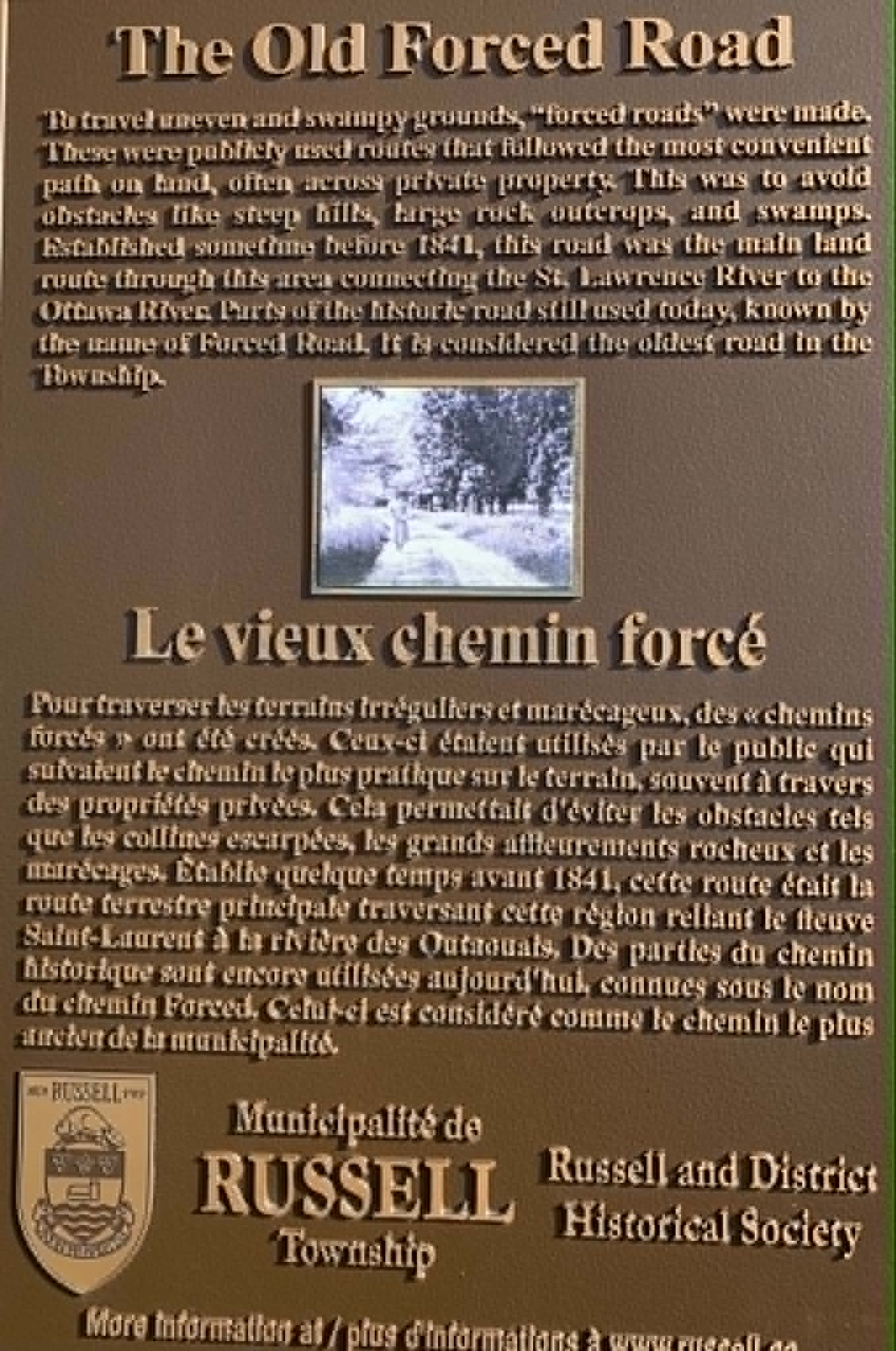
In 2022, the Township of Russell placed an historic plaque at the entrance to the NYC Recreation Trail along the Forced Rd.
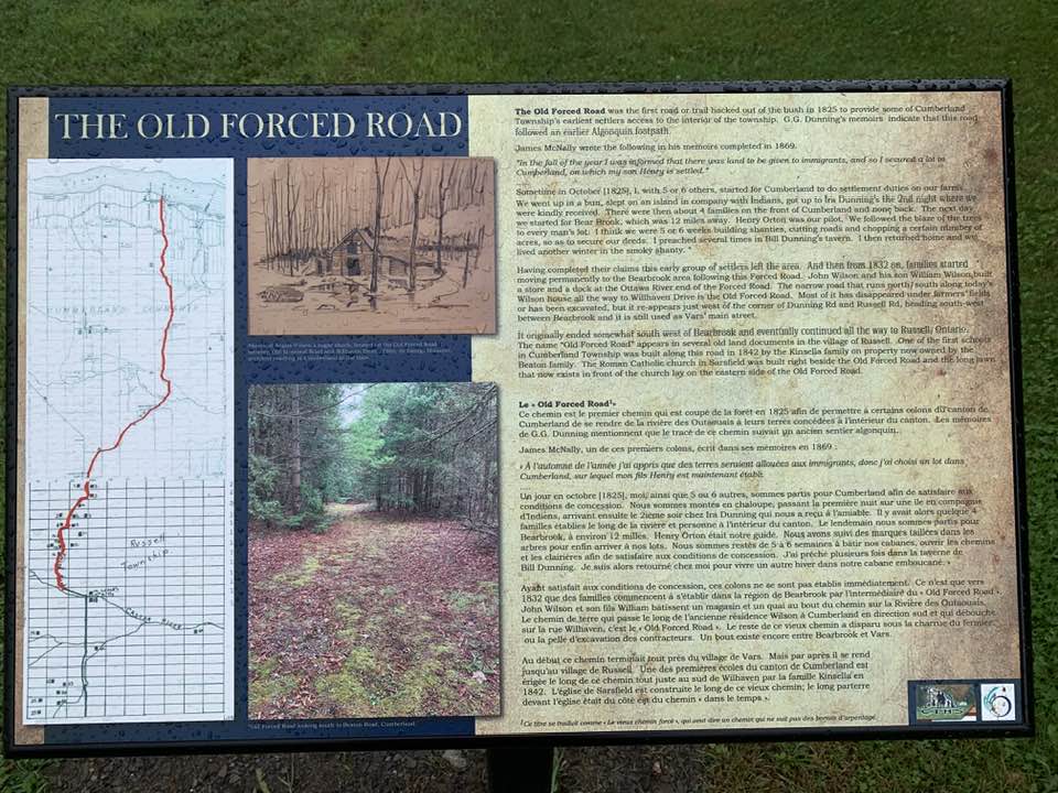
In 2023, the City of Ottawa erected a plaque at the Bearbrook Community Centre, 8720 Russell Road, commemorating the Old Forced Road connecting Russell Township through to the Village of Cumberland.
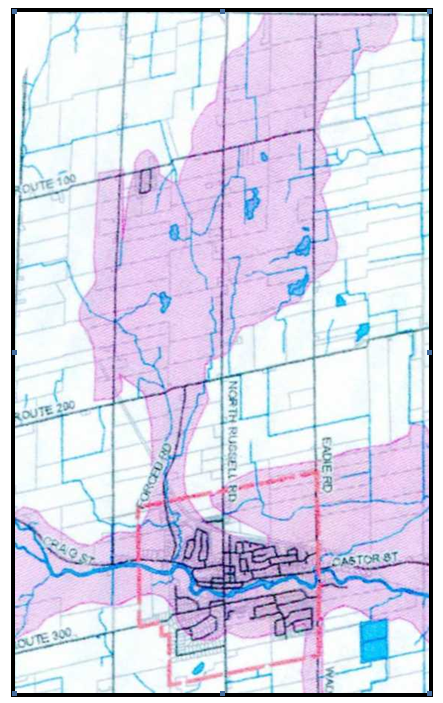
As part of the Township of Russell Official Plan (2006), Heritage Quest (2004) mapped areas of archaeological potential around navigable waterways, but also mapped a corridor that extends north along the old Forced Road and up through North Russell.
By 1820 most of the good farm land along “The Front”, as the townships along the St. Lawrence River were called, had been fully occupied. The survey of Russell Township was completed in 1822 and it was only a matter of time before a United Empire Loyalist would take the free land grant and move into this area.
First European Settlers
According to Wendell Stanley (1987) the first European settlers came to the area to lumber the forests in about 1820 and were made up of United Empire Loyalists that made their way to Canada from the United Sates during the American Revolution. Stanley (1987) reported that by 1832 there were only 5 families in Russell Township and by 1842 there was a population of 196.
The family of Elisha Fox Loucks (formerly spelled Loux) and Elizabeth Rupert were the first settlers in Russell Township. They were French protestants (Huguenots) that were persecuted by the French Catholics in Europe. They came from Luxembourg (Europe) to the Mohawk Valley (New York State, USA) and then to Osnabruck area of Upper Canada and then north to Russell along the Forced Road. In 1827 Elisha Fox Loucks was purchasing land and was operating what would be the first grist mill in Russell Township. It was water powered and was situated on the north side of the Castor River, just east of the Wade Road Bridge in an area that was known as Luxemburg. In 1829 Elisha Loucks built a log house at 1135 Eadie Rd (property is now owned by Jean and Gertrude Milliare at the corner of Eadie Rd. and Castor St.). By 1835 Elisha Loucks also had a sawmill.
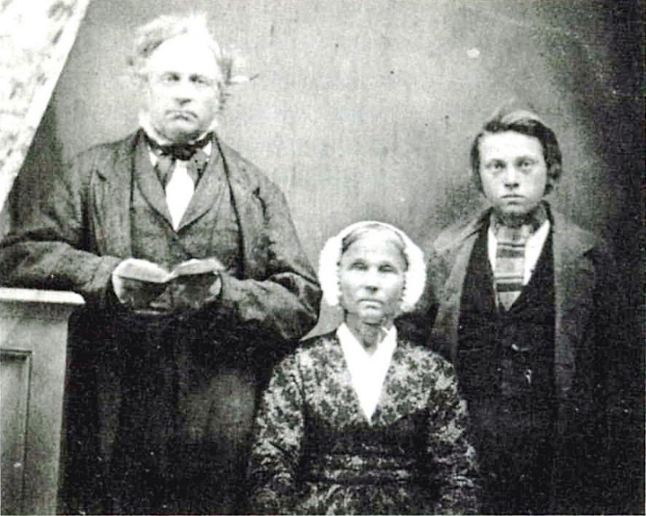
By the late 1820's, almost all of the reasonably fertile land in Carleton County had been taken, which meant that the settlers had to locate and farm on poor soil, forcing them to migrate to new areas such as Russell County which was opened up in the late 1840's and early 1850’s. Russell Township became an area of secondary settlement for a number of Carleton County families including the Argues, Booths, Bo(r)lands, Cherrys, Craigs, Harris, Morrows and Youngs.
Farming on Lot 15 Concession 2 on the old Forced Road
In 1850 Robert and Sarah (Lawlor) Young settled along the old Forced Road and John and Mary (McGuire) Borland settled next to them. The descendants of the Borland family still own property and live along the Forced Road. (Su Young the last descendant of the Young family to live on this road just sold her property and moved to Alberta.)
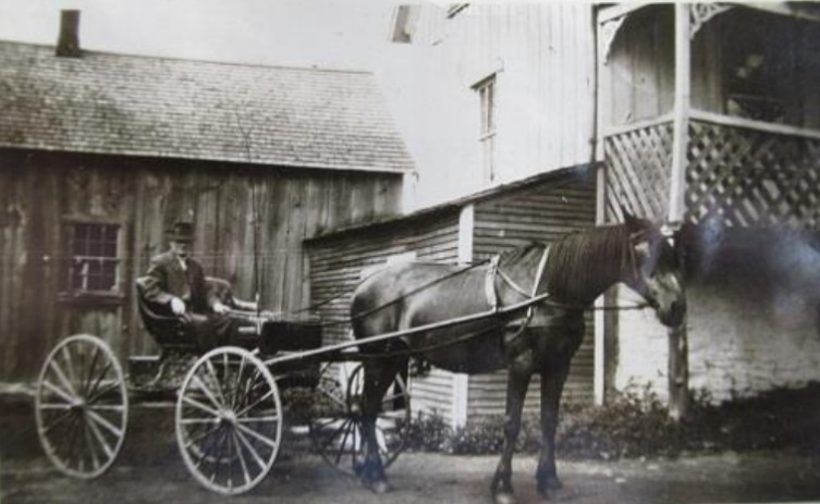
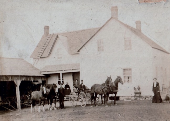
John Moffat purchased the Robert Young farm (at the end of the present Forced Road) in 1902 and his descendants farmed the land until 2000.
Thomas C. Young built the brick farm house “La Grange” in 1904.
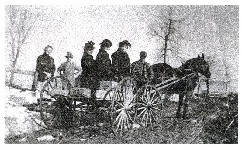
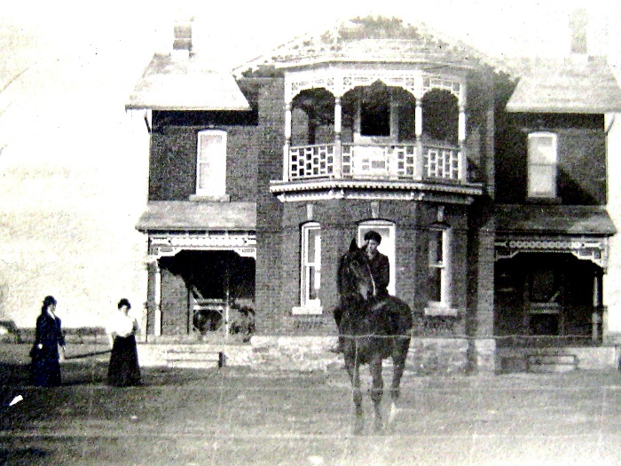
In 1857, Henry and his father William Fitzpatrick purchased the west half of Lot 12, Con 2 and the farm (on the present Forced Rd. near Craig St.) stayed in their family until 1929.
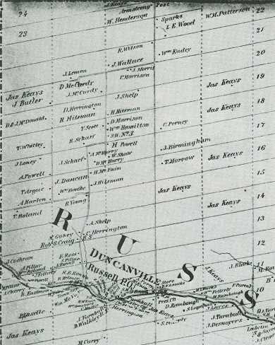
On the 1862 map above, the road north of the Village can be seen still following the old trail that extends up the old Forced Road in Concession 2 and makes a “dog leg” between Lots 17 and 18 and then turns north again on the west side of Concession 3.
By 1879 stage coaches were operating along the old Forced Road and post offices were located at each of the stop off places along the way from the St. Lawrence River north to the Village of Cumberland (Osbourne) on the Ottawa (Grand) River.
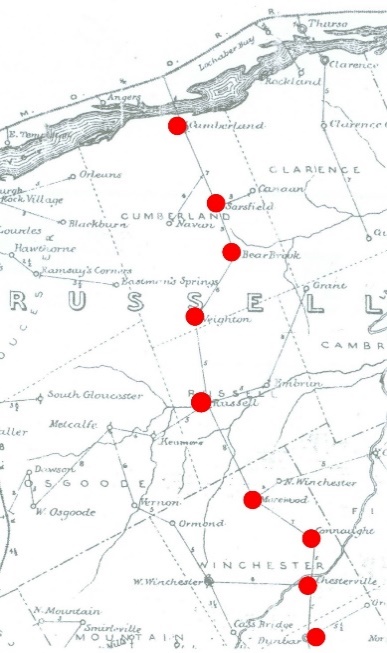
In 2016 the Cumberland Township Historical Society traced the old Forced Road south from Cumberland Village to the Russell Township northern border at Veighton (Boyer, 2017). Veighton was a post office/stop over located on McVagh Road near Burton Road.
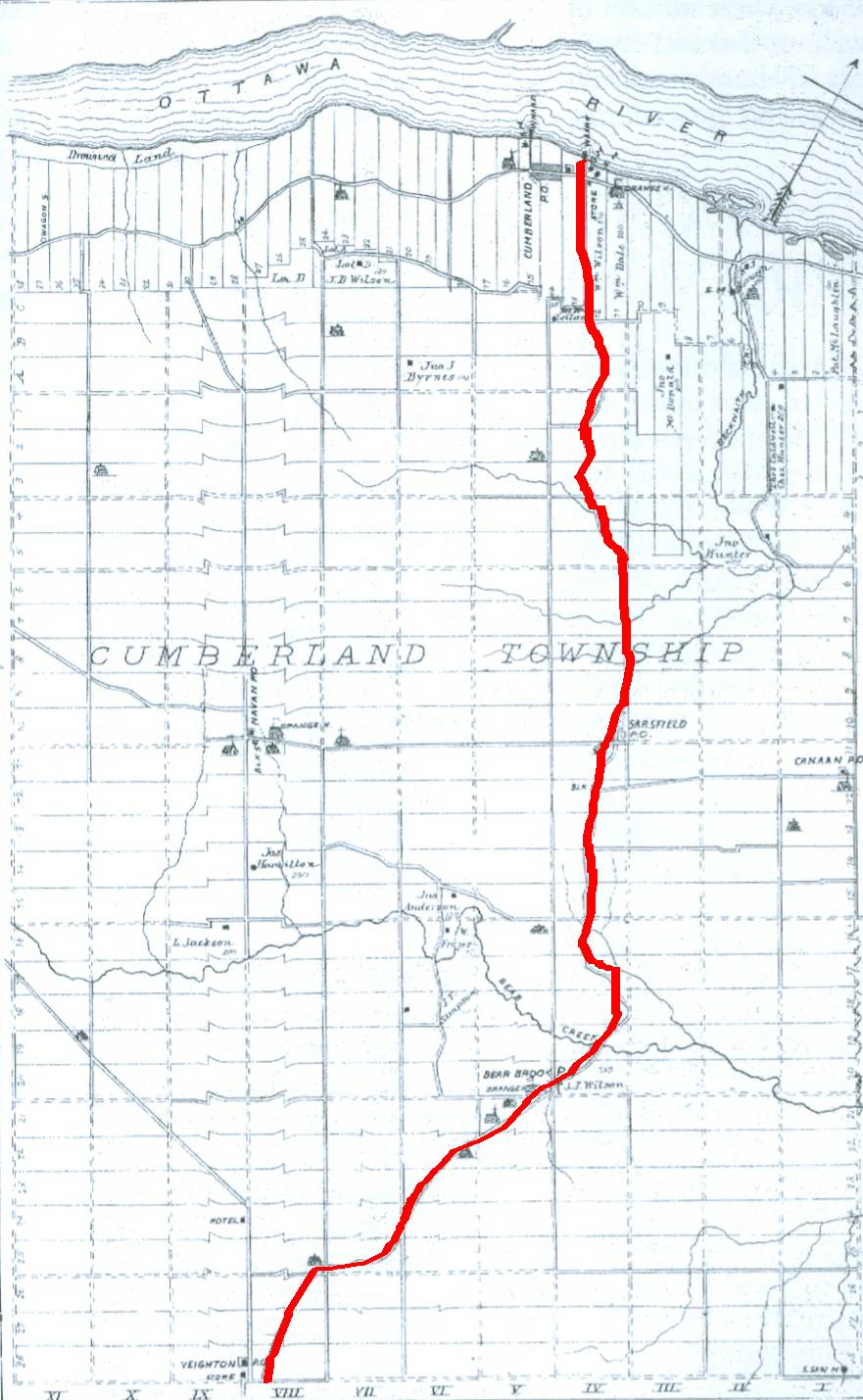
Prior to 1852, all land registrations for Russell County were filed and registered in the the Registry Office located in L’Orignal on the Ottawa River. If a resident of Duncanville in Russell County, wanted to register a land transaction, they would have to travel north on the old Forced Road either on horseback or by horse-drawn wagon to Cumberland and take a steamship down the Ottawa River to L’Orignal.
In 1852, James Keays was appointed Registrar for the County of Russell by the Parliament of the Province of Canada. He was instructed to open a Land Registry Office in the Village of Duncanville and on March 29, 1852 he received his first land registration for the County of Russell.
Duncanville was officially named the Village of Russell in 1898 by a resolution of the United Counties of Prescott-Russell.
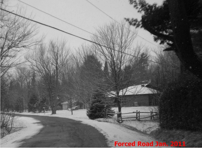
Today, two portions of the old Forced Road in Russell Township and Cumberland Township are still called “Forced Road”! Old time residents refer to it as “the Forced Road”. The Russell Township portion in the Village of Russell extends north of Craig St. to Route 200 and the Cumberland portion winds its way from Vars to Bearbrook.
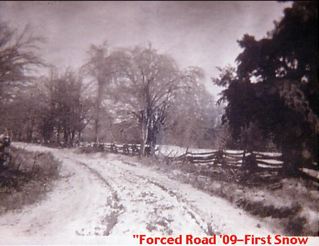
The historic tree-lined Forced Road in Russell has been a favourite route for tourists and residents in every season of the year.
Acknowledgements
Contributions to this article were received from: Roger Young, Su Young, Marjorie Moffat, Mary Boland, Donald McCaffrey, Bill Rombough, and Gerry Boyer.
References
Boyer, G.C. 2017. Map of Cumberland Township tracing the Old Forced Road.
Heritage Quest. 2004. Archaeological Resource Inventory and Assessment of Potential Russell Township, Prescott-Russell County, Appendix 11 of the Township of Russell Official Plan.
H. Belden & Co. 1867, 1879, 1881. Historical Atlas of Prescott & Russell, Stormont, Dundas, Glengarry Counties, Ontario.
MTBA Associates. 2019. Village of Russell Heritage Conservation District Study.
Stanley, W.M. 1987. From Swamp and Shanty – the history of Russell Village and the western part of Russell Township 1827-1987. Runge Press Ltd, Ottawa, Ontario.