
Mild November outlook meets a restless polar vortex
Dr. Judah Cohen sees a possible colder turn late this month or early in December, but the models have yet to back that idea firmly.
Judah Cohen, PhD, studies how Arctic snow, sea ice and the polar vortex influence winter weather. He directs seasonal forecasting at Atmospheric and Environmental Research and is a research scientist at the Massachusetts Institute of Technology. This series follows Dr. Cohen’s work for clues to the larger patterns that can affect eastern Ontario.
For now, the broad outlook still leans mild. In his Nov. 9 update, Dr. Cohen describes normal-to-above-normal temperatures across much of Canada in three forecast periods: Nov. 10–14, Nov. 15–19 and Nov. 20–24.
But he is watching for a change beyond that relatively gentle start.
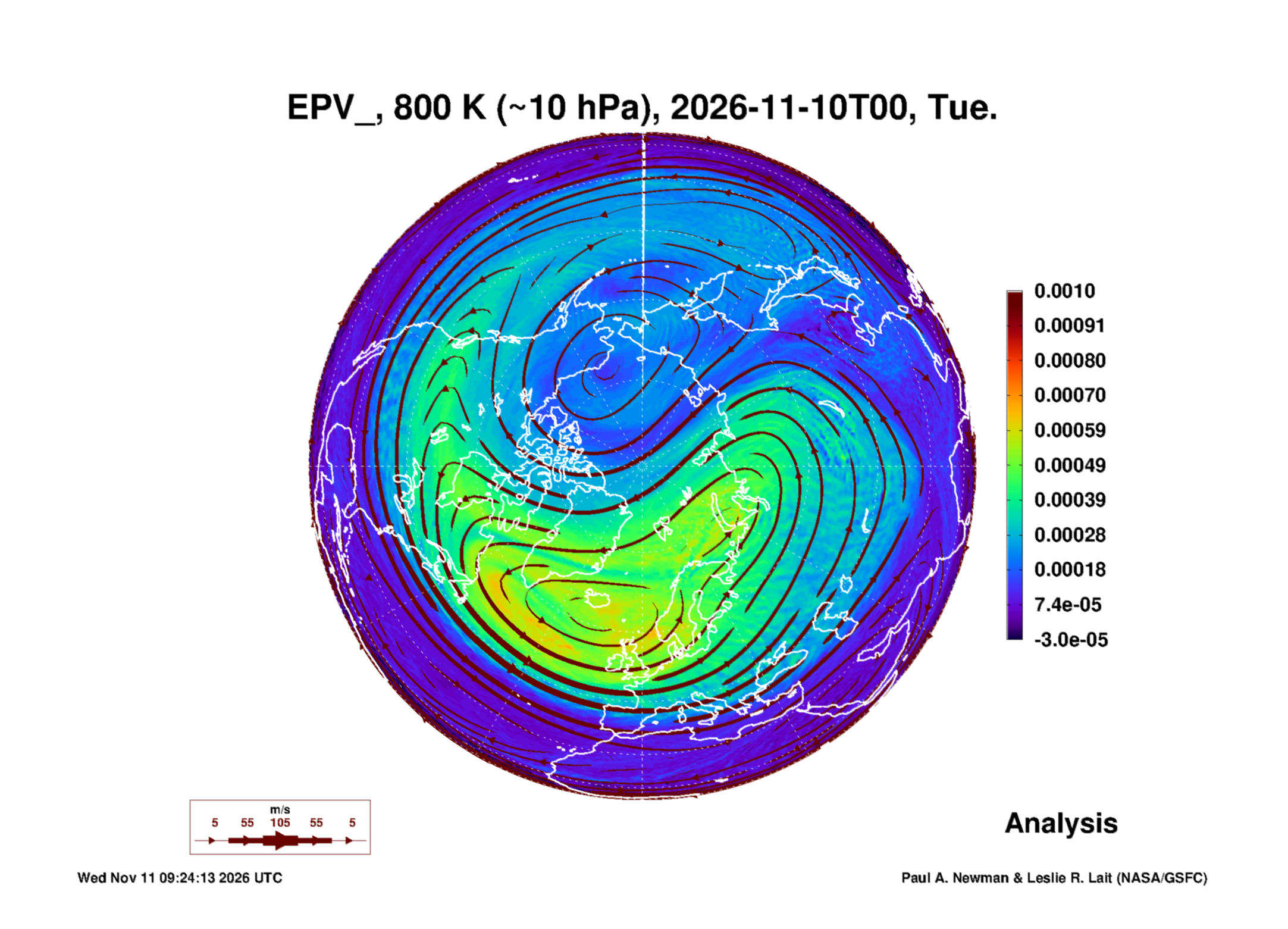
High above the Arctic, a major disturbance is developing in the polar vortex. Dr. Cohen expects it could evolve into an elongated, or stretched, shape. That possibility leads him to anticipate a colder North American pattern in late November or early December, despite models still favouring widespread warmth.
The science involves a part of the atmosphere far above everyday clouds. A sudden stratospheric warming happens when large atmospheric waves disturb the vortex, rapidly warming the polar stratosphere. In a major event, its usual west-to-east winds reverse. The name describes warming aloft, not a promise of warmer weather on the ground.
Such disruptions can influence where cold air travels, but the destination is uncertain. A dramatic Arctic change does not automatically mean a cold snap in Russell Township.
Dr. Cohen is not forecasting extreme December cold. He notes limited available cold air and wants stronger evidence before gaining confidence in the colder scenario.
For eastern Ontario, that makes this a development to follow, not a date to circle for a snowstorm. The near-term regional signal remains relatively mild. The later question is whether the altered Arctic circulation can change that pattern as December approaches.
Cohen material adapted with permission.
Credit: Judah Cohen and Janus Research Group.
Background: NASA Ozone Watch · National Weather Service explanation