
A mild winter? The polar vortex could still have a say
A powerful El Niño points towards a mild winter and Dr. Judah Cohen is closely watching the Arctic for clues about how warm it could actually be. He may also be the first to tell us if there's a deep freeze coming.
Ontario and southern Quebec are showing a particularly strong signal for an unusually warm December, according to The Weather Network's early outlook.
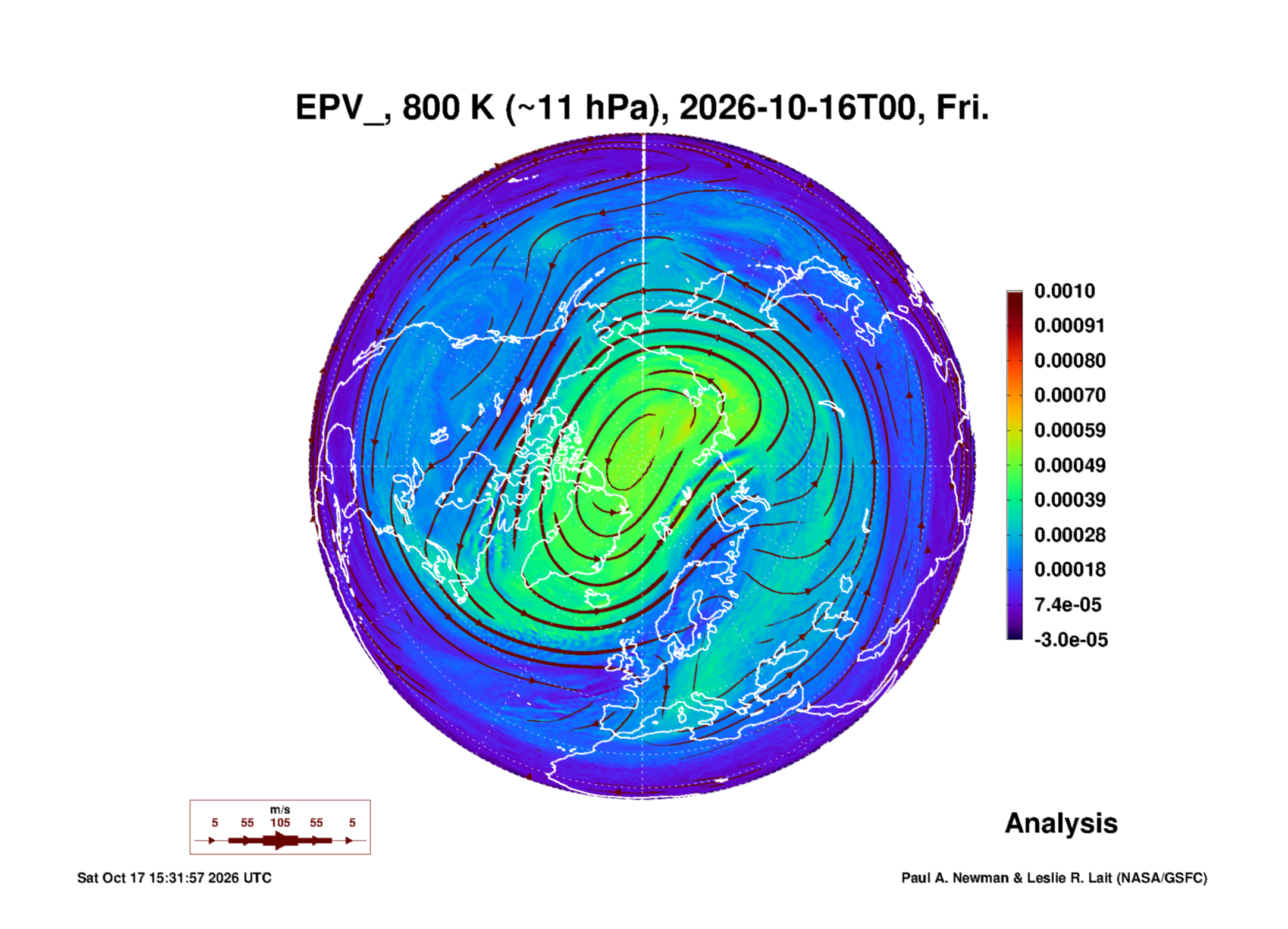
But that does not mean winter has been called off. High above the Arctic, the polar vortex remains a wildcard. Changes in that circulation can influence the cold that reaches farther south, complicating an otherwise mild outlook.
That is where Judah Cohen, PhD, comes in. A research scientist at the Massachusetts Institute of Technology and director of seasonal forecasting at Atmospheric and Environmental Research, part of Janus Research Group, Dr. Cohen studies the Arctic clues that help explain what might be coming our way. He has given The Rustler permission to summarize his work, bringing readers a regular look at the science behind the changing outlook. His work regularly offers insights into the weather that may lie weeks ahead, well beyond the day-to-day forecast.
In a sense, Dr. Cohen is a canary in winter's coal mine. He watches for changes that could offer an early warning of a sharp turn toward colder weather weeks before it arrives. His outlooks also examine where milder conditions may persist, helping readers follow the possibilities beyond the familiar day-to-day forecast.
His approach is to bring together Arctic observations and computer models, explain what the evidence suggests and identify where the picture remains uncertain. These are developing possibilities, not promises. The distinction matters when looking weeks ahead, when even a promising signal can change.
His Oct. 13 analysis begins with a prospect many readers may welcome: a milder turn next week. The outlook puts eastern Canada near or below normal temperatures from Oct. 14 to 18, followed by temperatures near or above normal across much of Canada from Oct. 19 to 23.
That could offer a break from the chill and a little more time to enjoy autumn outdoors. Warmer than usual in October is still October, though, and the question is how long the milder pattern might last.
Computer models favour widespread warmth from Oct. 24 to 28. Dr. Cohen, however, thinks eastern Canada could begin cooling again. He is watching for a possible stretching of the polar vortex around late October or early November, a development not yet firmly established in the models.
The polar vortex is a circulation high above the Arctic. Its changing shape is one of the clues Dr. Cohen follows when assessing the risk of cold weather farther south. It is not winter's only influence: Arctic outbreaks can occur without a disrupted vortex, and a disruption does not always translate into a change at ground level.
For eastern Ontario, the broad possibility is a cool–mild–cool sequence. For now a milder stretch is on the horizon.
Cohen material adapted with permission. Credit: Judah Cohen and Janus Research Group.
Sources
Dr. Cohen's Oct. 13 outlook. The Weather Network: Canada winter outlook; The Weather Network: eastern Canada outlook; The Weather Network: El Niño and polar vortex; MIT News: decoding the Arctic; NASA Goddard Arctic analysis.